Call Anytime
3D Laser Scanning and surveying Services

3D Laser Scanning and surveying Services
Using the most up-to-date laser scanning technology, Allyces offers a complete data capture solution that enables us to realistically map everything from large-scale city models to incredibly minute industrial components.
Many offshore platforms and rigs need regular upkeep and repair. To maintain secure and effective working environments, accurate information on these platforms is crucial. Our laser scanning services are assisting and prolonging the process by allowing engineers to choose the optimal locations for moving old equipment and placing new equipment.
Engineers can choose the optimum locations for moving old equipment and where to install new equipment thanks to our laser scanning services, which helps offshore platforms, last longer. This reduces the time and effort required for continuous work through decreased development, a sustained life cycle, and quick, precise measurements.
Hydrographic Surveys
- Side-scan
- Bottom/Channel Condition
- Dredge Monitoring
- Pipeline Location
- Highways, Transportation Systems, and Structures
- Single-beam
- Multi-beam
Surveying we offer include:
- High definition Surveys / Laser Scanning
- Aerial Surveys / Photogrammetry
- Site Detail & Feature Surveys
- Terrestrial Laser Scanning
- Mobile Laser Scanning
- Offshore Scanning
- Volumetric Surveys
- Lease Surveys
- As-constructed Survey
Terrestrial scanning produces high-resolution 3D photographs of surfaces and objects using a tripod-mounted or ground-based light radar. LIDAR operates by firing laser pulses at an item to be scanned, then measuring the strength of the laser pulses' return after reflecting off the object. Kilometer-scale scanning is possible with sub-centimeter accuracy. Terrestrial scanning is frequently used for MEP (Mechanical, Electrical and Plumbing) models, restricted space inspections, accident scenes, heritage documentation, and 3D topographical surveys.
SCAN to CAD Modeling
For reverse engineering and design, 3D laser scanning is ideal. Understanding site conditions and planning for new equipment installs, plumbing replacements, and HVAC replacements are all aided by the creation of models using scan data. We have scanned and provided 3D models for guarding design in Auto CAD, Catia, UG, and Nupas Cadmatic for a variety of applications.
Point Cloud Registration
Major software vendors have recently included point cloud solutions in their offerings. As a result, scanning is increasingly being used as a conventional data gathering technique for a wide range of applications. A 3D point cloud survey can offer a solution to the most difficult data gathering problems, from architectural to industrial.
SCAN to BIM Modeling
By detecting errors and preventing rework, as-built BIM models of the site created using scan data may save a lot of time and thousands of rupees. Periodic comparisons between the design model and the as-built BIM models may be made using 3D laser scanning to continuously collect real-time site data. Before expensive rework is necessary, any abnormalities may be found, evaluated, and corrected.
3D Laser Scanning
Any place, including industrial facilities, building sites, excavation pits, monuments, and almost anything that has to be digitized in a short amount of time may be created with the use of 3D laser scanning. 3D laser scanning scans up to 1 million points per second in a 360-degree horizontal and 320-degree zenith using a laser, often a Class 1 laser. The 3d models or 2d drawings are produced using a point cloud, which is a collection of points that have been registered on a website.

Surveying Benefits
- Reduced survey time. Laser scanning collects data about existing structures in a fraction of the time of traditional methods and with fewer people
- Efficient collaboration.
- Identifying coordination issues.
- Software integration.

Do you have a Technical Issues?
How do I get services for digital landscape modeling for my company?
Although land surveying methods can also be used, photogrammetry is frequently used to construct digital elevation models. There are now data elevation data sets available that can bring you up to speed for your mapping operations. Before, producing high-quality mapping data was a highly specialised field needing expensive equipment and highly skilled staff. Also, it has becoming simpler to merge different data sources, such satellite and aerial photos, or to gather your own data using drones. The greatest option for producing digital elevation models and their derivatives, however, will be a geospatial data service provider for precise, dependable, and surveying-grade outputs.
How does 3D Laser Scanning Work?
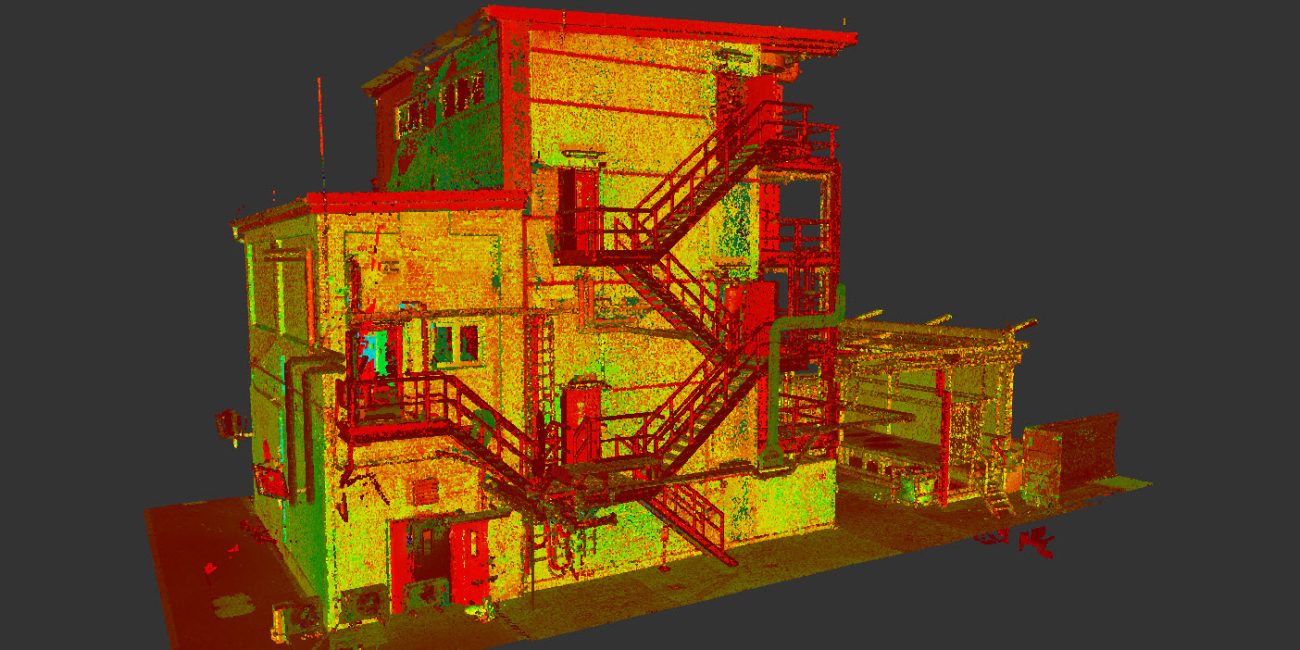
The 3D Laser Scanner sends out a laser beam which then reflects off objects and returns to the scanners sensor. The scanner then uses its on-board computer to calculate where in space the return came from and creates an X, Y, Z coordinate relative to the Centre of the scanner for each return. Some Scanners are capable of doing this up to 1,000,000 times a second. The result of this scanning process is a Point Cloud.
What does the point cloud look like if I don’t get the color photos taken?
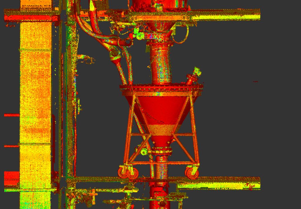
As well as recording an X,Y,Z coordinate for each return to the scanners sensor, most scanners also record an intensity of the returned light. When put into the registration software this return intensity value is used to display either a grey scale or RGB gradient colour value for each point. Most software is capable of displaying these colour values and as such it is still very easy to make out everything in the point cloud. Sometimes it is easier to see the details using the grey scale or RGB gradient as the cameras in the scanners are still not that great and most industrial facilities lighting layouts didn't have photography in mind when they were designed.
